Districts of Kazakhstan
Cities and places of Kazakhstan Districts
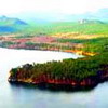 |
Akmola District The ancient culture of Kazakhstan, a wealth of attractions and unique nature charm visitors with their beauty and uniqueness. In the very heart of Kazakhstan, 160 km northwest of Astana, the Kurgalja National Reserve is set in the Tengiz Kurgalja Depression, where steppe and semi-desert meet, separating Kazakh sandstone from the Kokchetau Hills. The reserve covers 237,100 hectares of shrubbery and grass, typical of the steppe ... |
 |
Aktyube District Aktyube District is one of the most significant industrial areas of Kazakhstan. It occupies an area of approximately 300,000 sq. km. and borders Russia in the north, Uzbekistan in the south, and in the east and west three Districts of Kazakhstan. (In the east Kostanai, Karaganda and Kyzylorda; in the west Atyrau, Mangistau and West Kazakhstan) ... |
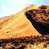 |
Almaty District The Almaty District was created on March 1Oth1997, by uniting with the Taldykorgan province, thus, it became 5th in the country in area, which is 224,000 sq. km., equal to the entire area of such European states as Greece and Hungarycombined. The Oblast occupies the whole southeast of the Republic, the territory which is called Zhetysu (Semirechye) ... |
 |
Atyrau District Atyrau District features 400m steep slopes and dazzling and perfectly round stones 2 m in diameter. This protected limestone plateau was once the bottom of a prehistoric ocean. The Caspian and Aral seas are its remains. Here the arid steppe meets the wetlands of the Ural River(Zhaik in Kazakh), which resemble the swamps of Florida ... |
 |
Karaganda District Saryarka: what Kazakh people have historically called the territory located in the central part of Kazakhstan. The largest part of Karaganda district consists of a long line of mountain ranges: in the east are the Kyzylarai Mountains, in the northeast the Karkaralinsk Mountains, and in in the west the Ulytau ... |
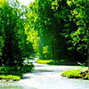 |
Kostanai District Tо many people, Kostanai District is associated with the concept of the "virgin lands" campaign. Today, it is the largest grain supplier in Kazakhstan. The district also has well-developed processing and food industries. This area is one of the largest in Kazakhstan. It is located at the junction of the Ural mountains, West Siberian Plain and Turgai Plateau. The biggest rivers flowing across Kostanai district are the Tobol and Turgai. The Tobol river is the most interesting due to the many legends associated with it ... |
 |
Kyzylorda District Kyzylorda District is located in the southwest of Kazakhstan. Its administrative center is Kyzylorda. The depths of the Earth here are rich in mineral deposits. That is why the key branch of economy of the district is the mining industry. However, the territory of Kyzylorda District accommodates numerous architectural ... |
 |
Mangistau District The Treasure Peninsula... This is the common nickname of one of the richest areas of Kazakhstan - Mangistau District. This land is rich in oil, gas, raw materials, and various ores and minerals. It is also true that present day Mangistau is called a land of tourism and recreation resources, with a rich cultural heritage ... |
 |
Pavlodar District This area of Kazakhstan is famous for its remarkable Bayan-Aul National Park, one of the most picturesque places in the country. It is set within a hundred kilometers of Ekibastuz, a city with developed industry. This National Park features four types of vegetation: forest, shrub, steppe and meadow ... |
 |
North Kazakhstan District Uralsk is the administrative center of the district (founded in 1613) and one of the oldest towns in Kazakhstan. It is situated on the right bank of the Ural River at the confluence of the Chagan River, and with its forests and pastures was suitable for the camps of nomads, Scythians, and others ... |
 |
East Kazakhstan District The nature of East Kazakhstan is amazing. The steppe and semi-desert zones of Asia meet the mountainous taiga of Siberia, giving birth to ua nique landscape spectrum: deserts, steppes, taiga, mountains with eternally sparkling glaciers, numerous rivers and lakes ... |
 |
South Kazakhstan District Kazakhstan is a land of ancient civilizations. Since time immemorial, its inhabitants have been creating an outstanding and original culture. South Kazakhstan District is famous mostly for its historical memorials - burial mounds, sites of ancient settlements, fortresses, mausoleums and ancient towns. The center of South Kazakhstan District, Shymkent city with its population of about half a millon people, is the third in size in Kazakhstan ... |
 |
West Kazakhstan District The administrative center of the district is Uralsk, the oldest city in Kazakhstan. Another largely populated industrial city is Aksai, the center of the Burlinski administrative area. It is a city of oiland gas industry workers. West Kazakhstan District is not only an economic and industrial area but also one of the most unique corners of Kazakhstan ... |
 |
Zhambyl District Zhambyl District is a huge territory, stretching from the vast Betpak-Dala desert to the magnificent Tien Shan and from the Chu valley to the Karatau Mountains. The administrative center of the district is Taraz, situated in the south of Kazakhstan. Taraz is by right one of the most ancient cities in Kazakhstan (in 2002 it celebrated its 2,000 year anniversary). Chinese records dating back to the middle of the 1stcentury BC mention this city ... |
