Western Kazakhstan
About Kazakhstan regions. Pictures of Kazakhstan
 West Kazakhstan Region is the gate to the central and southern parts of Kazakhstan and to the Central Asian countries. It is located in the northwest of the republic. Huge natural resources, an advantageous geographic location, and developed economic links with many Russian cities and neighboring countries create favorable conditions for the successful development of external economic activity.
Western Kazakhstan includes the West Kazakhstan, Atyrau, Mangistau and Aktyubinsk Provinces. The region is situated in the utmost west and southwest of the Republic. Its vast territory stretches for 1200 km from north to south and for 1300 km from west to east.
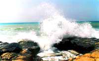
The main rivers are the Ural and the Emba. The largest lakes are the Inder, Aralsor, and Kamis-Samarskiye. A most important role is played by the Caspian Sea. Oil production has been developing for 100 years in this region. Atyrau is the main center for the production and conservation of black caviar. The climate here is extreme continental, and dry.

The Great Silk Road passed through the whole territory of Mangistau for 2000 years. Lately, it has become a very interesting tourist route. The presence of beautiful landscapes, along with the great diversity of fauna of the Ustyurt Reserve, the unique historical and cultural as well as natural monuments in which Mangistau abounds, and the picturesque places of the Caspian area represent a considerable interest for a potential tourist.
Aktyube Region is one of the most significant industrial areas of Kazakhstan. It occupies an area of approximately 300,000 sq. km. Aktyube Region borders on Russia in the north and Uzbekistan in the south. It is interesting that in the east and west, three Kazakhstan regions on each side adjoin this area. In the east these are Kostanai, Karaganda and Kyzylorda Regions; in the west - Atyrau, Mangistau and West KazakhstanRegions.

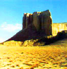
Atyrau Region is a kingdom of steep 400m slopes and absolutely white, perfectly shaped stone spheres of about 2m in diameter. This reserved land represents a limestone plateau, once the bottom of a prehistoric ocean.
The Caspian and Aral seas are its remains. The arid steppe zone meets with the flowing lands of the Ural river (Zhaik in Kazakh) which here and there resembles the swamps of Florida. This is truly a heaven for various waterfowl. Only air cushion watercraft are permitted here. Flocks of swans, ducks and geese sweep over the heads of astonished travelers who are shocked by the greatness of their number.
The Treasure Peninsula.... This is how people call one of the richest areas of Kazakhstan. Mangistau Region - this land is rich in oil, gas, construction materials, and various ores and minerals. It is also true that present-day Mangistau is called a land of tourism and recreation, with a rich cultural heritage.
Archaeological Monuments
 Ancient burial sites were found to the north of Kizan, on the banks of the Dead Kultuk.
They go back as far as the 4th-5th centuries BC. Experts acknowledge that this discovery may shed new light on the ancient peoples of the Sako-Massaget period who used to live in this area.
Situated 18 km from Shetpe, the Akmish areaenchants travelers with its historical sites at ancient Kizil-Kala (which stands for "red town" in Kazakh). Three kilometres from Akmishsay, the picturesque canyons of Samal and Sazanbayappear.
Hanga-Baba Tract, another surprising spot, is situated 30 km from Fort Shevchenko. Here one can find spring water, hawthorn and blackberry bushes, mulberry, elm and poplar groves. Ancient Hanga-Baba Necropolis, including a mosque, is also situated here.
