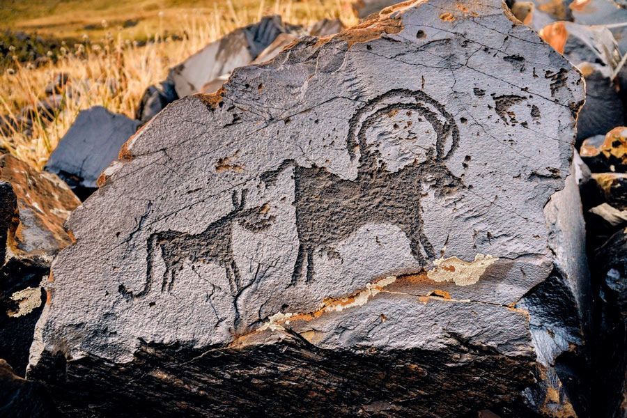
Saimaluu Tash (Saymaluu-Tash), Kyrgyzstan

Hidden away at over 3,000 meters in the Ferghana range, about 100km morthwest of Djalalabad, near Kurgat Pass, is the remote, modest plateau of Sailamu-Tash. The name means "Patterned stone" and refers to the fact that located here is a gallery of thousands of petroglyphs, which are littered around the landscape. Saimulu Tash means "embroidered stones" in Kyrgyz, which aptly describes the scene.
There are estimated to be around 11,000 indivual drawings scattered over two moraine slopes, three kilometers in total length. The first contains the vast majority of the pictograms - about 9,500. In the middle is a small pond which is considered holy, and is known to have been used as a site for meditations by local shamans.
Some of the drawings date from at least 2000 B.C. - some sources suggest 3000 B.C. It is thought that they represent votive offerings brought by locals from the valleys to be nearer the heavens. There are images of animals, carts, agricultural activities such as ploughing, and traditional ritual dances, all without any background. The number of solar images suggests that sun-worship was the common religion in the region.
The stones were revealed to the outside world when, in 1902, the Russians decided to build a road from the town of Djalalabad in the Ferghana Valley to their outpost at Naryn. The result was the present Kazarman road - which is spectacular but nearly impassable most of the year. One of the cartographers, Nikolai Hludov, became fascinated by stories he heard from the local shepherds about "painted stones" in the mountains, and organized a small expedition to investigate. He reported his findings to the Archeological Society in Tashkent, and an expedition to excavate the site was organized. Similar discoveries in France and political considerations dictated, however, that the site remained relatively unexplored until the 1950's.
The site is sometimes called the Stonehenge of Central Asia, which helps to encapsulate the importance and capture the spirit of the the historical artifacts found here. Unlike Stonehenge, however (which has a superhighway passing only a couple of hundred meters from the standing stones), there is no easy way of reaching the site. The main route is from the village of Kalmak Kirchin, some 60km from Djalalabad, along a rough track (passable by sturdy 4WD only) up to a small "honey farm" high in the mountains. From here, the rest of the way, (10 kilometers), must be completed on foot or horseback. A newly published book (2002) - "Petroglyphs of Central Asia" profiles the archaeological expeditions to Saimaluu Tash and a number of other important sites.
CBT Makmal (Kazarman)
Kazarman village is located in Jalalabat Oblast, not far from the border with Naryn, near the famous Makmal gold mine. From here it's possible to take a trip to the world famous Saimaluu-Tash rock paintings gallery listed as a UNESCO World Cultural Heritage site and now under its protection. Saimaluu-Tash is a small plateau hidden among the peaks of the Fergana range at 3000 meters above sea level. Black rocks with petroglyphs date back to the Bronze and early iron Ages. Visitors never forget the special atmosphere of this place full of the ancient artists' skill surrounded by staggeringly beautiful scenery. The road to Saimaluu-Tash can only be used for one month a year - from approximately mid-July till mid-August. The first snow falls in September. Kazarman can be reached from Jalalabat (157km from Jalalabat town) or Naryn Oblast (220km from Naryn town).
