Beldersay - Ski Resort in Uzbekistan
Regions: Greater Chimgan Mountain, Tashkent Region
Official Language: Uzbek
Living Nationalities: Uzbeks, Russians, etc.
Time Zone: UTC+5
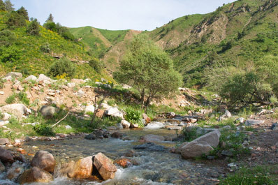
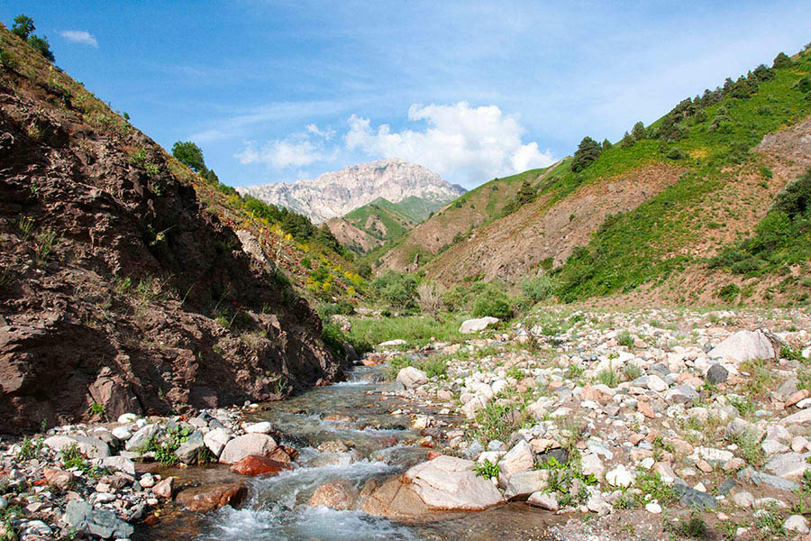
Beldersay is a ski resort in Uzbekistan, popular among both tourists and locals. The resort takes its name from the Beldersay River (sai), which flows through the area.
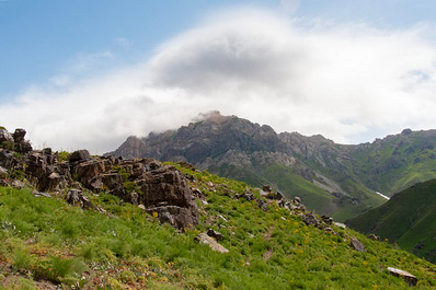
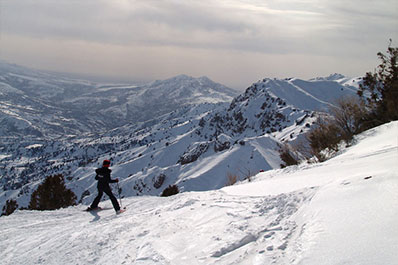
Beldersay Gorge is stunning in any season. In winter, visitors can admire snow-covered landscapes and enjoy skiing, snowboarding, and sledding. Spring brings blooming mountain meadows, while summer and autumn are perfect for hiking, berry-picking, and collecting medicinal herbs.
The surroundings of Beldersay offer a variety of attractions, including the Charvak Reservoir, scenic gorges, and an area with ancient petroglyphs. Additionally, two other ski resorts, Amirsay and Chimgan, are located nearby.
Brief History of Beldersay
Beldersay is located on the slopes of Mount Kumbel, just 5 kilometers from Chimgan. The area is named after the Beldersay River, which was formed by melting snow and rainfall. More than 20 mountain tributaries flow into Beldersay, making its water ice-cold even in summer.
The Beldersay River merges into the Aksakatasai River, which then flows into the Chirchik River.
A notable feature of the area is the Marble River, a tributary of Beldersay, where fossilized shells dating back several million years can be found. Some researchers believe that this region was once covered by an ancient sea, possibly the Tethys Ocean.
In the 1980s, a ski resort with a cable car was built in Beldersay, marking the beginning of its development as a popular winter tourism destination.
Beldersay Attractions
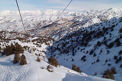
One of the main attractions of Beldersay is the famous cable car, which takes visitors from Beldersay Gorge to Kumbel Peak at an altitude of 2200 meters above sea level. Built in the 1980s, the 2.5-kilometer cable car offers breathtaking panoramic views. On weekends, be prepared for long queues.
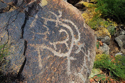
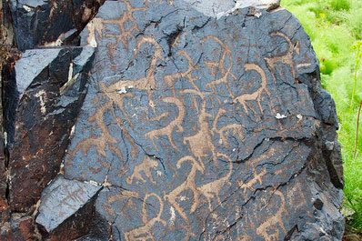
The ancient petroglyphs in the Beldersay area are another fascinating site. Scientists believe that the earliest rock paintings here date back 10,000 years, while the most recent ones are around 6,000 years old. These petroglyphs are located at an altitude of 2450 meters above sea level and are usually accessible to those willing to embark on a short mountain hike.
For those who enjoy hiking, a visit to the Marble River is a must. The trail to this natural wonder is relatively easy, making it suitable even for children.
Not far from Beldersay is Charvak Reservoir, the most famous body of water in Uzbekistan. Visitors can admire its azure waters, relax on the shore, or go for a swim in the summer months.
Things to Do in Beldersay
Beldersay is a popular destination for skiing, snowboarding, and sledding, attracting both beginners and experienced athletes. The resort offers three slopes with different difficulty levels, ensuring a great experience for all skill levels. In addition to winter sports, visitors come to enjoy the clean mountain air and stunning landscapes.
During the summer months, a trip to Charvak Reservoir is a great option, as it is located nearby. This scenic spot offers opportunities for swimming, boating, and relaxing by the water. The Beldersay resort area also has numerous hotels and guesthouses with swimming pools, providing a comfortable retreat in warm weather.
For those who love hiking and adventure, Beldersay offers excellent trekking routes leading to mountain peaks with breathtaking views. Rock climbing enthusiasts can also find challenging cliffs to test their skills.
How to Get to Beldersay
The fastest and most convenient way to reach Beldersay is by car from Tashkent, covering a distance of just over 80 kilometers. The road is scenic and well-maintained, making for a pleasant drive.
For those relying on public transportation, shuttle buses (marshrutkas) run from the Buyuk Ipak Yuli metro station (often still referred to by its old name, Maxim Gorky). These marshrutkas travel to Gazalkent, where you will need to take a private cab to Beldersay.
If you prefer train travel, you can take a train to Gazalkent and then continue your journey by car or taxi.
Food in Beldersay
Beldersay has cafés and restaurants where you can enjoy traditional Uzbek cuisine. While there are no unique local dishes specific to the area, many visitors note that food always tastes better in the mountains.
Try tender kebabs grilled over an open fire, hot pilaf prepared with fragrant spices, and tea infused with mountain herbs. Enjoy your meal while taking in the stunning views of Beldersay's scenic landscapes.
What to Buy in Beldersay
As you leave Beldersay, keep an eye out for local vendors along the road. They offer several types of mountain honey, collected from various plants and flowers, known for its rich flavor and health benefits. You can also buy kurt—small, sun-dried sour milk balls that make for a great snack or souvenir from your trip.
Safety in Beldersay
Beldersay is generally a safe place to visit, but it is important to take precautions when exploring the mountains. It is advisable to wear special mountain boots or at least non-slip shoes, as the terrain can be uneven, increasing the risk of falls.
The region has a sharply continental climate, meaning temperatures can fluctuate significantly. Even in summer, daytime heat can give way to cold evenings, so bringing a light jacket is recommended. In winter, wearing thermal underwear will help keep you warm.
Additionally, sunglasses and sunscreen are essential year-round, as the mountain sun is intense regardless of the season.
Best Time to Visit Beldersay
Beldersay is a year-round destination, offering different attractions in every season.
In summer, visitors can swim in cool mountain waters, enjoy hiking, and explore the breathtaking landscapes. Winter is perfect for skiing, snowboarding, and sledding, as the slopes are covered in snow from December to March, and sometimes even into April.
In spring, the mountains are in full bloom, with lush green meadows and colorful wildflowers. Autumn is the quietest time, ideal for those who want to escape the crowds and enjoy peaceful mountain scenery.


