Karshi, Uzbekistan
65°48'00" E
Former names: Nakhshab, Nasaf, Bekbudi
Elevation: 386 m
Popular languages:Uzbek, Tajik
Time zone: UTC+5
Nationals: Uzbek, Tajik, Russian, Tatar
Phone code: +998 75
Zip code: 1801XX
Automobile codes: 70
Karshi is one of the oldest cities in Uzbekistan and was once part of the Greco-Bactrian kingdom. More than 300 artifacts from ancient settlements have been discovered in its vicinity. Caravans of the Great Silk Road also passed through Karshi, highlighting its historical significance.
Located in the oasis of the Kashkadarya River, Karshi is now the largest city and administrative center of the Kashkadarya region, with a population of over 266,000. It attracts both domestic and international tourists with its rich history, ancient settlements, architectural monuments, and distinctive cuisine. Just 10 kilometers from the city, visitors can explore the remains of Erkurgan, a settlement founded no later than the 11th century BC.
Additionally, the region is known for the Shurtan gas field, an important part of Uzbekistan’s energy sector.
Brief History of Karshi
Karshi was founded in the 7th century BC, as confirmed by numerous archaeological discoveries. In 2006, under the auspices of UNESCO, Uzbekistan celebrated the city's 2700th anniversary.
The city's name dates back to the Mongol conquest. According to Babur-name, a historical account written by Babur, a descendant of Amir Timur, "Karshi" means "cemetery" in Mongolian.
However, many modern researchers believe the name originates from the Turkic language, meaning "fortification."
Throughout its history, Karshi was conquered by the armies of Alexander the Great, the Arabs, and the Mongols. With each new ruler, the city was often renamed, at different times being called Navtak, Nasaf, Nakhsheb, Bekbudi, and possibly even Eukratidea. The name "Karshi" was already found in written sources as early as the 11th century.
How to Get to Karshi
The fastest and most convenient way to reach Karshi is by air. Regular flights connect the city with Tashkent and Moscow.
For those who prefer train travel, Karshi can be reached by rail from Tashkent, Termez, Andijan, Kitab, Dushanbe, and Volgograd. Some trains also make short stops in Bukhara and other small settlements in Uzbekistan.
Buses and minibuses operate between Karshi and almost all major cities in Uzbekistan. Additionally, private taxis are available from any settlement in the country, offering a flexible and comfortable travel option.
Karshi Attractions
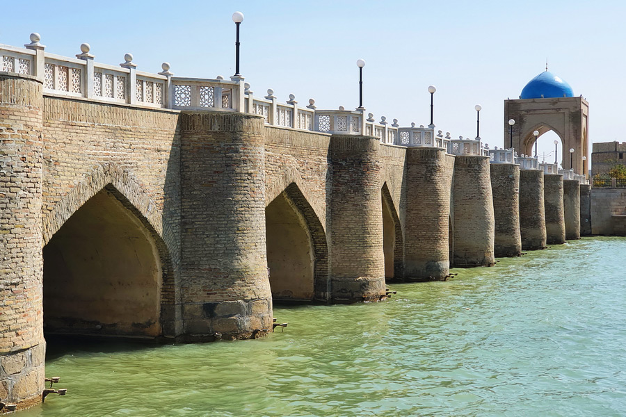
The Karshi Bridge, built over the Kashkadarya River in 1583 during the reign of the Sheibanids, is one of the city's most iconic landmarks. The 122-meter brick bridge remains a protected historical monument.
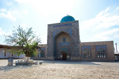
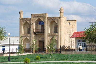
The famous Odina Mosque, originally constructed in 1386 by order of Amir Timur, was later rebuilt under Abdullah II in the 16th century. For over 500 years, it served as a place of worship until the 1930s when it was repurposed as a prison. After 1991, the mosque was restored and now houses the “Memory of the Victims of Repressions” museum.
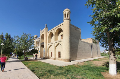
Adjacent to the Odin Mosque stands the Odina Madrasah, built in the 16th century. Notably, it was the only educational institution in the region where women studied Islam. Today, the historic madrasah serves as a museum.
The memorial complex of Abu Ubaida ibn al-Jarrah, located near Karshi, is a significant pilgrimage site. It is believed to have healing properties, and many visitors come with the hope that their prayers and wishes will be fulfilled. Abu Ubaida ibn al-Jarrah was one of the earliest followers of Islam during the time of Prophet Muhammad.
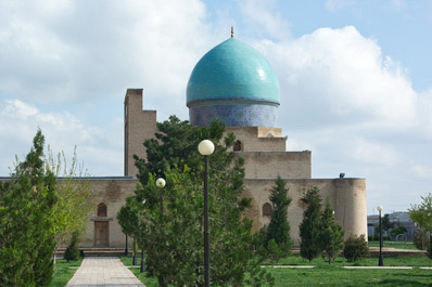
Karshi is home to several mosques dating back to the 15th century and beyond. Notable examples include Kok Gumbaz and Bekmir, built in the 16th century, as well as Charmgar, Magzon, Khoja Kurban, and Kilichboy, which were constructed between the 19th and 20th centuries.
The remains of Kalai-Zohaki-Maron, an ancient settlement founded in the 2nd century BC, can be found within Karshi. At its peak, it was one of the largest cities in Central Asia.
Just 10 kilometers from Karshi lie the ruins of Erkurgan, a settlement that existed as early as the 9th-8th centuries BC. It was a significant cultural and economic hub until its destruction in the 6th century.
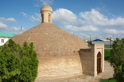
Another notable historical structure in Karshi is the sardoba, an ancient irrigation system used for water storage. Sardobas are dome-covered reservoirs that protected water from dust, dirt, and evaporation in the hot climate. At one time, 29 such reservoirs existed around Karshi, and in 2019, the sardoba was featured on the city’s logo.
Food in Karshi
In addition to traditional Uzbek cuisine, Karshi is known for a few unique specialties. One of the most famous is tandyr-gusht, a dish of lamb seasoned with spices, covered with juniper branches, and slow-cooked in a tandyr (clay oven), giving it a distinct aroma and flavor.
Karshi is also famous for its small samsa, made using a special local recipe, and umakai-jiz, a dish named after the village of Umakai in the Kashkadarya region. Unlike most dishes, umakai-jiz is not ordered in portions but by the kilogram, making it a popular choice for gatherings and feasts.


